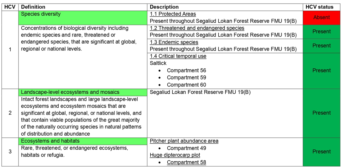
HIGH CONSERVATION VALUE FOREST (HCVF) MONITORING
As part of the forest management certification process, Segaliud Lokan Forest Reserve FMU 19(B) had to identify High Conservation Value sites as to provide management and monitoring recommendations to ensure that the forestry activities do not negatively impact HCVs attributes that were present. The assessment was conducted in accordance with the Malaysian Toolkit for HCVF and Pro-forest Toolkit to interpret HCV definitions.
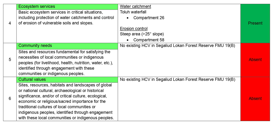
The status of HCV and details of HCV monitoring 2023 is summarized as below:
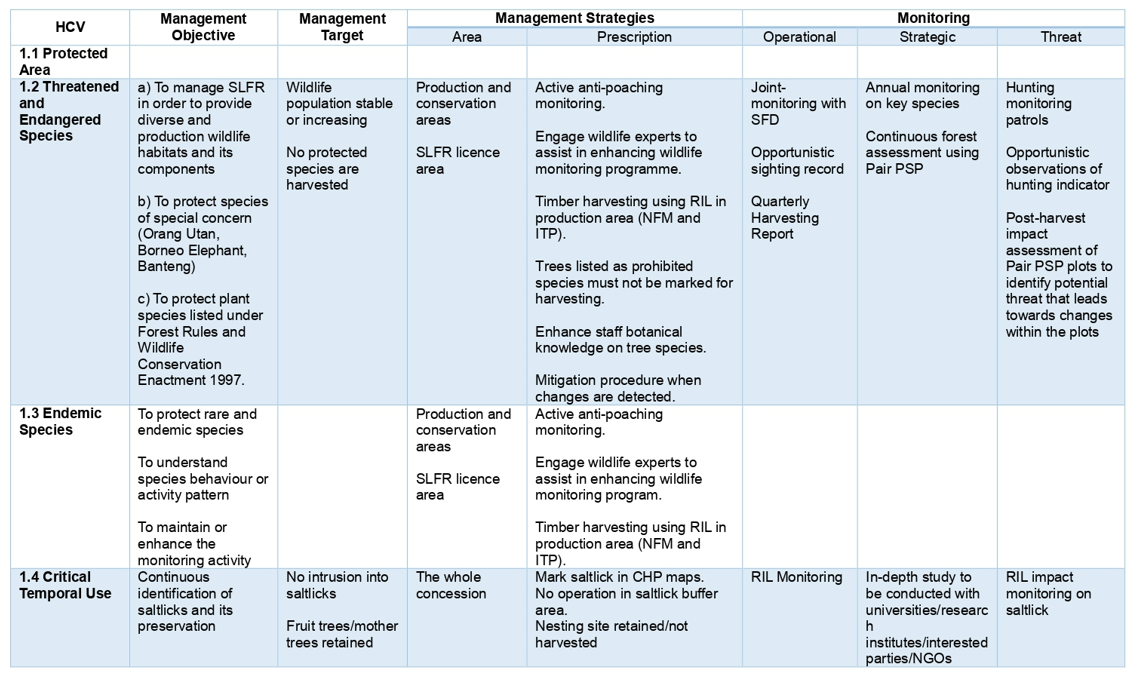
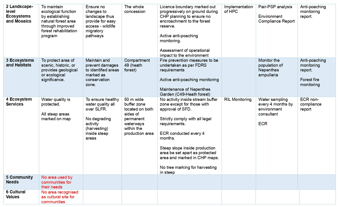
HCV MANAGEMENT